Where is she?

Sunday, 13 November 2011

384 km - 577 km

After a day of resting in Whangarei, it was time to hit the trail again. Sjoerd was longing to see a bit more of NZ then hiking trails, and dropped me off at the oil raffinary at Marsden point, a funny place to drop off a lady.. ;). Under a sky covered with clouds I continued walking along the beach down south. I took me a while to get used to walking on my own again. Sometimes I felt a bit unsafe as well, being all by myself, even though everyone I met was very friendly and helpful.

A challenge presented itself at the end of the day when I approached a river mouth. I had made the decision not to take the detour but cross the river which would be possible at low tide. When I arrived it was 45 min after low tide. I rearranged my backpack in case it would get wet, took off my socks and trousers, and entered the river at the place that I was advised... The first part was okay, the water was up to my knees and while I kept walking I was making progress. And then  it got deeper, and deeper.. up to my thighs. I felt my feet sinking deeper into the sand and the strong current around my legs. I was grateful to have my walking sticks for balance. I kept going until I lost balance for a second and almost fell. That was scary!! Not wanting to take any more risks, I turned around, and was offered a lift around the river by a friendle couple from Mangawai. I felt glad I had made a sensible decision.

Another difficult part was walking a few kms over the rocks at low tide. The only alternative was walking on the state highway which was not really an option. So I asked two different people about the tides and the possibilty to walk over the rocks. One of them said: 'Oh, it's not difficult at all.' So I left, and the first part was indeed not difficult, until I reached some parts with very slippery rocks and lots of slippery seaweed. It took me ages to cover a few hundred metres because of taking every step with care.
The landscape was constantly changing: beaches, coastlines with rocks, forrest, towns, some road walking etc.. Along the way I regurlary met people who came up to me, mentioning my big backpack, asking where I am going. Some offered me a place to sleep or some land to pitch my tent which was very kind. When I approached a river a local man got his rowing boat out and rowed me across to the other side.

It took seven days to walk the 193 km from Marsden point to Auckland. On average I walked 27 km a day. Fortunately the weather was not as hot as before, making the walk a bit easier. Also, by this time I had learned which things in my backpack were useful and which were useless, so my backpack had a right weight.
A physical update of what appeared and disappeared again during the past seven walking days:
- three new blisters
- red burning rash on upper legs (no idea why)
- bite of tick in upper leg (got it out)
- sunburn upperlegs
- neck: painful to turn my head to the left (after waking up one morning)
- lots of sandfly bites


On my own again...

Walking across the rocks at low tide from Waiwera to Orewa

Funny and beautifully shaped rocks
 

I camped in a pristine little forrest.
No one noticed I was even there except for
the ducks and sheep...
The trail...


The ferry from Devonport to the city centre of Aucklnad

YES!!! I made it to Auckland and the sun is shining :))

Half way the hike described above I took a wonderful break to spend some time visting Rotorua with Sjoerd. Rotorua is famous for its geothermal activity and has geysers and hot mudpools. I was amazed... We camped next to a river with boiling! water. Steam was rising up next to our tent. It was nice to soak in the thermal pools and in a natural hot pool in the forrest. My muscles relaxed again :)


Thermal park in Rotorua
(I liked the flowers a bit more then the mudpools, hence no mudpools on this photo)


Finally arriving in Auckland was a nice experience. The sun was shining and I enjoyed meeting up with a fellow hiker, Kenyon from Australia, who was on a few day recovery-from-blisters break. We compared gear, maps and shared stories.


My map (left) and Kenyons map.. Find the differences :)


 Time has flown by and I will not be able to reach Wellington before my flight back to the Netherlands. In Auckland I had a talk with myself about the next weeks (my last precious weeks in NZ). I enjoyed the past 600 km on the North Island very much, but the next part around Hamilton will be quite flat and might be quite boring...For this reason I decided to go back to the South Island.. surprise! surprise! Within a few weeks I hope to post here a next story about the first part of the Te Araroa trail of the South Island..

To be continued...


Back on the South Island..
Wow..... :)


Thursday, 27 October 2011

222 km - 384 km

I will continue my story with what happened after we left the jungles and had that delicious burger in Whapapa village. We continued walking that evening to Kerikeri (both feeling reaaally tired, Sjoerd: "not another 8 km!"). A rainbow appeared in the sky when we walked into the town The rainbow seemed to promise something good.. And good things came: a shower, a washing machine, no rain and heaps of sun, bays and beaches. We enjoyed a  day of rest in Kerikeri, a very nice town. All the residents seemed to have vegetable gardens and all the trees and flowers seemed to blossom and spread pleasant smells (a bit like paradise to me). After Kerikeri we entered the Bay of Islands and then we followed the less busy coastline down to Bream head. We passed many tiny towns, lots of cows, and wonderful secluded bays

I am starting to get used to the daily rhytm of getting up at sunrise, put on my shoes, walk 20-something km, take off my shoes and go to sleep at sunset. It also has been fun walking together with Sjoerd and sharing the good times (wonderful views and landscapes) and the less good times (no streams for ages while being thirsty and without water, feeling exhausted because of the heat, loosing the trail in an estuary full of mud and sharp shells).

The current state of me: no blisters (they have healed), sometimes close to being sunburnt or getting a heatstroke (but not there yet :), feeling happy and enjoying the whole adventure.

We are now on a campsite in Whangarei (this is not part of the trail but we hitch-hiked to here). A hot spa is waiting for me now (hmmm....) so I will end this written story here. I trust the photos below will continue telling you the story...

Arrival at Kerikeri


One of the oldest houses of New Zealand from 1832, located in Kerikeri


Camping in Russell forrest


The summit of Mnt Bledisloe with a view across the Bay of Islands

Beautiful horses in Paihia


The beach of .. (I forgot, Sjoerd says Matapouri). I loved the maze


And the beach at the bay of ... (forgot again). An awesome place though, and the backyard of some very lucky people.

Early morning boat trip across Ngunguru river with a local fisherman  


Walking at low tide across the Taiharuru river


A camping spot with a view across Ocean beach


The first light of the day

Sunrise :)

Good attempt :)

The summit-without-name of 476 m high. This rock is the remain of an old volcano. A great hike up! until we were back down at the road and realised the SPOT locator beacon was still on top of the summit... Had to climb up and down another time.

This is Ocean beach, and the village with the same name where we realised we had a few peanuts and some chocopasta left for a full day hike. There were no shops around within the next 12 km. We made it through the day though.

Tuesday, 18 October 2011

100 km - 222 km

Wow... remember these four forrests I mentioned in my last  message? Well, they were not just forrests.. but jungles!!
I will start this story from the beginning: after completing Ninety mile beach I enjoyed a day of rest in laid-back Ahipara. I spend it relaxing in the shadow, treating my blisters and eating three meals with lots of vegetables and protein. I also enjoyed talking with Oliver from Nelson who is touring the North Island on his motorbike. In the evening the whole campsite gathered to watch the Rugby World cup which is like the World Soccer Championship in Holland. Argentina had to face the All blacks. I enjoyed watching the game, but still have to get used to the fact that (unlike soccer) jumping and lying on top of each other is part of the game.

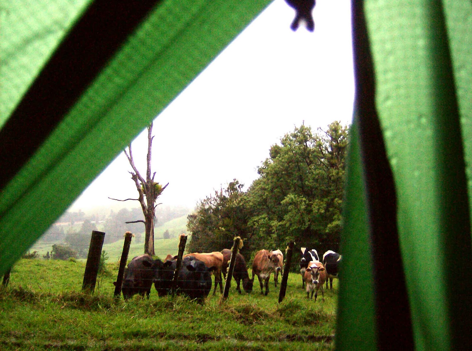
I decided to head off to Herekino forrest on Monday. The start of the day was very pleasant until I entered the forrest. It started to rain and didn’t stop until the next morning!!! I was wearing my rainclothes but everything underneath got completely soaked as well. Around 5:30 pm I hadn’t reached the edge of the forrest and started to worry about not finding a place to camp before dark. I kept going: climbing over branches, sliding down through the mud, jumping over mudpools, trying to keep lianes out of my face. Fortunately I reached the end of the forrest just before dark and camped under the trees overlooking a pleasantly looking meadow. Cows with very kind eyes stared into my tent: welcome company J. I put on my last pair of dry clothes and snuggled into my sleeping bag.
The next morning I stepped into a big mudpool. Haha.. I couldn’t be bothered anymore, being covered in mud already and half of my clothes being wet. When I arrived in the village of Takahue, the first car that passed offered me a ride. I happily took it. The next two days I dried all my clothes in Kataia. Kataia is not a nice town. It has lots of empty and ravaged buildings. I stayed in the cheapest and oldest hotel in town, where not much seemed to have changed since the 50's.
On Wednesday I met up with Sjoerd, who had arrived from Holland. Sjoerd is going to accompany me on my hike during the next two weeks. He has never done much hiking before, but is a good mountainbiker and in good shape because of that. On Thursday we hitch-hiked back to the spot where I had stopped, ready to cross the next three forrests…It took five full days through mud, rivers, cows muck, ferns etc to cover the distance to Keri-Keri. Just like ninety mile beach, it was tough and great  at the same time. I think the pictures below tell the story the best. Enjoy J
Oh, the score: no more new blisters, some new freckles on my face, a bit more callus on the soles of my feet, shoulders feel okay, some triggerpoints between my shoulderblades, lots of sandfly bites on lower legs, no other complaints J
Up until now I am truly enjoying the hike. I am grateful for the opportunity to do something that I feel a big passion for. We are planning to continue in the direction of Whangarei tomorrow..

The first forrest after Ahipara, 8 hours to Diggers valley road.


Camping at the edge of Herekino forrest

'Drying' my clothes in the morning after walking in the rain the entire previous day

My lovely 50? year old hotel room in Kataia, drying all my gear: tent, sleepingbag, clothes, raingear..

Sjoerd and me, in Raetea forrest.

Camping on top of Raetea hill 740 m


The giants of the forrest

The walking trail..

Me feeling tired and about to enter the 3rd forrest: Omahuta


Farmland after leaving Raetea forrest

Finally, a view! A nice change after seeing nothing but trunks, leaves and ferns for two days

Camping  in Omahuta forrest. After searching in the rain for the trail with gps and maps, we finally found it. It got late, so we decided to camp on the trail. I love the clouds drifting through the valley..

We thought the people who made the map had been kidding: 'Walk through the stream. Have a wash.' it said... When the trail suddenly ended, it turned out they had not been kidding... 5 km of walking through the stream

It does not feel bad, just a bit wet

Puketi forrest


At 5 pm yesterday we walked around a corner... and saw a whole street full of cafe's and takeaways. Wow!! I thoroughly enjoyed this veggie burger.
Waipapa village